Description
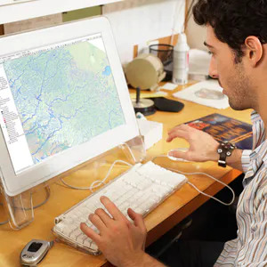
Geographic Information Systems (GIS) Specialization is a training course for mapping your world using GIS, where you will learn the tools, concepts and technical terms of spatial analysis and modeling. Knowledge of geographic information systems is highly requested by different industries from agriculture to public health. This course series will teach you all the necessary skills to successfully use the GIS program in a professional environment. You will learn how to analyze your spatial data, use mapping techniques to communicate results on maps, and collaborate with peers in GIS and GIS-related fields.
What you will learn in the Geographic Information Systems (GIS) Specialization course:
- Creating and working with raster data
- Data development and analysis for geographic analysis projects
- Developing a large processing workflow in ModelBuilder
- Interpret and explain the results you obtained in comparison to the original problem and/or GIS hypothesis
Course details:
Publisher: Coursera
teacher: Nick Santos
English language
Education level: introductory
Number of courses: 5
Duration: hours and minutes
Courses available in Geographic Information Systems (GIS) Specialization:
COURSE 1
Fundamentals of GIS
COURSE 2
GIS Data Formats, Design and Quality
COURSE 3
Geospatial and Environmental Analysis
COURSE 4
Imagery, Automation, and Applications
COURSE 5
Geospatial Analysis Project
Course prerequisites:
The specialization uses ArcGIS for Desktop. Instructions will be provided inside the course to download a free educational license. Please check below to make sure your computer meets the requirements to run ArcGIS.
ArcGIS requires a computer running Microsoft Windows, please visit Esri’s website to view the current system requirements for ArcGIS Desktop: http://desktop.arcgis.com/en/desktop/latest/get-started/system-requirements/arcgis-desktop- system-requirements.html.
If you would like to take the course using a Mac, it is possible, but you must feel comfortable setting up and installing Microsoft Windows on your Mac, either using virtualization software such as VirtualBox (free), BootCamp (free), Parallels, or VMWare. If you do not already have a Windows license, a free trial is available, but then you may be required to purchase a license in the future. A forum post in the first course includes tips from other students who have gone through the courses using a Mac to help you get set up. Still, getting the software set up on a Mac (or Linux) is ultimately up to you and not currently a supported configuration for this course. We hope to offer cross-platform training in the near future.
This specialization is for beginners, and assumes no pre-existing knowledge of GIS. Pre-existing knowledge in GIS will help you absorb concepts more quickly, but is not required.
Pictures
Sample video
Installation guide
After Extract, view with your favorite Player.
Subtitles: English and other languages
Quality: 720
This collection includes 5 different courses.
download link
Download the Fundamentals of GIS course 2021-3
Download the course GIS Data Formats, Design and Quality 2021-3
Download Geospatial and Environmental Analysis course 2021-3
Download the Imagery, Automation, and Applications course 2021-3
Download the Geospatial Analysis Project 2021-3 course
Password file(s): www.downloadly.ir
Size
0.98 GB + 1.29 GB + 701 MB + 1.28 GB + 1.41 GB
Be the first to comment