Description
CAD-Earth is a software for exchanging images, objects, lines and earth meshes between Google Earth and famous CAD software. With this, you can use the complications and elevations of the land in CAD software and have more accurate and realistic maps. It is very easy to use this program and you can easily access its commands from the toolbar or the corresponding menu. Arqcom, the manufacturer of this product, supports famous software such as Autocad and has always considered Bricscad and ZWCAD in the CAD-Earth development project. Various operations such as previewing designs, jerking and rotating the map, and changing various parameters are processed at high speed in CAD-Earth, allowing users to focus on map design instead of getting involved in repetitive details.
Features and features of the CAD-Earth tool:
- Importing Google Earth images to CAD software
- Export a screenshot of the map to Google Earth
- The possibility of using geographic reference images
- Importing Google Earth data into CAD
- Export CAD objects to Google Earth
- Support more than 3000 global coordinate systems
- Intersection of meshes and sections
- Showing cross-sections of meshes
- And …
CAD Earth system requirements
CAD-Earth does not need any additional requirements from the ones needed to run your CAD program optimally (please consult your documentation). Google Earth™ Free or Pro version 5 or newer must be installed in your computer. If you don’t have Google Earth™ installed, you can download the free version from: http://www.google.com/earth/download/ge/agree.html. Currently, CAD-Earth works in Windows Vista, 7, 8 and 10 in 32 and 64 bits and in the following CAD programs: AutoCAD Full 2010-2017 (and vertical products ie Civil3D, Map, etc) and BricsCAD V14-V16 Pro/ Platinum.
Earth CAD images
Installation guide
First, install the appropriate version with AutoCad installed on your system, AutoCad may run automatically after the installation is finished, close it, copy the patch file in the crack folder to the software installation location and run it in Run As mode. Run Administrator. Click on Patch and in the opened window, select the CADEARTH.dll file from the software installation location. You should see the Successfully Patched message. Then run AutoCad, select Apply license and Pause/Start Subscription from the CAD-Earth menu in the License management section. The program is now ready to use. You can check the activation status from the same menu, Help section, About option.
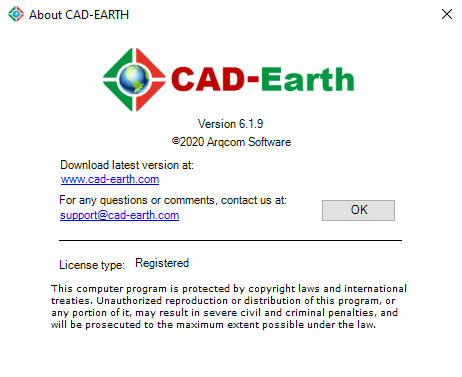
CAD-Earth v6.1.9 was installed on Windows 10 64-bit edition on December 30, 1999 and – as shown in the picture – was successfully activated.
download link
Download Arqcom CAD-Earth 8.0.3 for AutoCAD 2021-2024 x64
Download Arqcom CAD-Earth 7.0.2 for AutoCAD 2018-2022 x64
Download Arqcom CAD-Earth v7.0.1 for AutoCAD 2017-2022
Download Arqcom CAD-Earth v6.1.9 for AutoCAD 2017-2021, BricsCAD 19-20
Download ArqCOM CivilCAD Suite build October 2020
Download Arqcom CAD-Earth 6.0 for AutoCAD 2019-2020
Download Arqcom CAD-Earth 5.1.22 for AutoCAD 2010-2020, BricsCAD 15-19, ZWCAD 2014-2018
Download Arqcom CAD Earth 5.1 for AutoCAD 2007-2017 BricsCAD 14-16
Password file(s): www.downloadly.ir
Size
134 MB